Algarve
The Algarve is the southernmost NUTS II region of continental Portugal. It has an area of 4997 km2 with 467,495 permanent inhabitants and incorporates 16 municipalities (concelhos or municípios in Portuguese).
The region has its administrative centre in the city of Faro, where both the region's international airport (IATA: FAO) and public university, the University of Algarve, are located. The region coincides with Faro District and is subdivided into two zones, one to the West (Barlavento) and another to the East (Sotavento). Tourism and related activities are extensive and make up the bulk of the Algarve's summer economy. Production of food, which includes fish and other seafood, as well as different types of fruit and vegetables, such as oranges, figs, plums, carob pods, almonds, avocados, tomatoes, cauliflowers, strawberries, and raspberries, are also economically important in the region.
Although Lisbon surpasses the Algarve in terms of tourism revenue, the Algarve is still, overall, considered to be the biggest and most important Portuguese tourist region, having received an estimated total of 7.1 million tourists in 2017. Its population triples in the peak holiday season due to seasonal residents. Due to the high standards of quality of life, mainly regarding safety and access to public health services, as well as due to cultural factors and considerably good weather conditions, the Algarve is becoming increasingly sought after, mostly by central and northern Europeans, as a permanent place to settle. Several studies and reports have concluded that the Algarve is among the world's best places to retire.
The Algarve is the fourth most developed Portuguese region – in 2019, it was placed fourth out of seven regions with a human development index (HDI) of 0.847 (Portugal's HDI average was 0.864 in 2019). With a GDP per capita at 85.2% of the European Union average, it has the second highest purchasing power in the country, standing only behind Lisbon Metropolitan Area.
Map - Algarve
Map
Country - Portugal
 |
 |
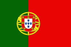
| Flag of Portugal | |
One of the oldest countries in Europe, its territory has been continuously settled, invaded and fought over since prehistoric times. The territory was first inhabited by pre-Roman and Celtic peoples who had contact with Phoenicians, ancient Greeks and Carthaginians. It was later ruled by the Romans, followed by the invasions of Germanic peoples and the Islamic invasion by the Moors, whose rule was eventually expelled during the Reconquista. Founded first as a county of the Kingdom of León in 868, gained its independence as the Kingdom of Portugal with the Treaty of Zamora in 1143.
Currency / Language
| ISO | Currency | Symbol | Significant figures |
|---|---|---|---|
| EUR | Euro | € | 2 |
| ISO | Language |
|---|---|
| PT | Portuguese language |


